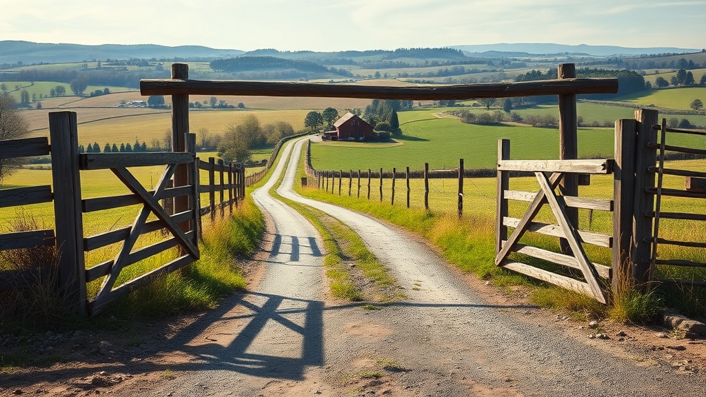
Public land offers opportunity, but it requires more preparation than hunting a familiar private property. This checklist covers access, rules, and safety so you can hunt with confidence on any public ground, whether it is a National Forest, BLM land, or a state wildlife management area.
Pre-trip access checks
- Confirm the unit or area is open to hunting.
- Read land manager rules for the specific area.
- Download offline maps and boundaries.
- Verify parking and access points.
- Check fire restrictions and vehicle rules.
Each of these items deserves more than a checkbox. Here is what to actually verify:
Confirm hunting is allowed. Not all public land is open to hunting. National Parks prohibit hunting except in rare, specifically authorized cases.1 Some National Wildlife Refuges allow hunting only during designated seasons and only for specific species. State parks vary widely – some allow hunting, others do not, and a few allow hunting only in designated areas or during special managed hunts.
Read the land manager’s specific rules. Federal land managers (BLM, USFS, USFWS) and state agencies each publish their own regulations that layer on top of state hunting regulations. A National Forest may restrict motorized access during certain seasons. A BLM Wilderness Study Area may prohibit vehicle access entirely. A state WMA may require a special area permit in addition to your regular hunting license.
Download offline maps and boundaries. Cell service is unreliable on most public land. Download maps before you leave. Use at least two sources – your state wildlife agency’s map and a tool like onX Hunt, HuntStand, or Gaia GPS – to confirm boundaries. Land ownership boundaries on digital maps can be off by tens or hundreds of yards. When in doubt, stay well inside public land boundaries.
Verify parking and access points. Some trailheads and access roads require high clearance or four-wheel drive. Others are gated seasonally. Call the local ranger district or land manager office if you are unsure about road conditions, especially for early-season or late-season hunts when roads may be muddy or snow-covered.
Check fire restrictions and vehicle rules. Fire restrictions change throughout the year and can prohibit campfires, charcoal grills, and even smoking in certain areas. Some areas restrict vehicle travel to designated roads only, which limits where you can park and how far you must hike to reach hunting areas.
Understanding different public land types
Not all public land is managed the same way. The rules that govern your hunt depend on who manages the land.
BLM (Bureau of Land Management) land. BLM manages roughly 245 million acres, primarily in western states.2 Most BLM land is open to hunting under state regulations. Dispersed camping is generally allowed. Vehicle travel rules vary by area – some allow cross-country travel, others restrict vehicles to designated roads and trails. Check the local BLM field office website for travel management maps.
National Forest (USFS) land. The Forest Service manages about 193 million acres.3 Hunting is generally allowed under state regulations. Seasonal road closures are common during hunting season to protect habitat or manage access. Some Forests have motorized use restrictions or designated Wilderness areas where no mechanized transport (including game carts) is allowed.
State Wildlife Management Areas (WMAs). These are managed specifically for wildlife and hunting. Rules vary significantly by state and by individual WMA. Many require a special area permit or a WMA stamp. Some restrict weapon types, hunting methods, or the number of hunters allowed per day. Check-in and check-out procedures may be mandatory. Daily quota hunts are common at popular WMAs.
National Wildlife Refuges (USFWS). Refuges that allow hunting publish a hunt plan with specific dates, species, weapon types, and access rules. Many Refuges require a free or low-cost hunt permit in addition to your state license. Refuge hunt plans can be highly restrictive – certain areas may be closed, certain blinds may be assigned by lottery, and hunting hours may differ from state regulations.4
Army Corps of Engineers land. Corps land surrounding reservoirs and waterways is sometimes open to hunting. Rules vary by project and district. Some Corps land is leased to state agencies and managed as WMAs; other parcels are open under general state regulations. Contact the local Corps office for specifics.
Navigation and mapping
Use at least two map sources to confirm boundaries. Mark entry points, water, and terrain features. Plan a primary route and a backup route. Save pins for parking and trailheads.
Thorough navigation prep prevents trespassing, getting lost, and wasting time on inaccessible routes. Build your map layer by layer:
- Land ownership boundaries. This is non-negotiable. Know exactly where public land ends and private land begins. Corner-crossing laws vary by state, so do not assume you can cross private land at a section corner to reach landlocked public parcels.
- Topography. Study contour lines to identify ridges, saddles, benches, creek bottoms, and other terrain features that funnel game movement. Mark these as waypoints.
- Water sources. In arid western terrain, water is a game magnet. Mark springs, stock tanks, creeks, and seeps. In eastern forests, water is less of a limiting factor, but creek crossings and beaver ponds still concentrate activity.
- Roads, trails, and access gates. Mark every road and trail on your map. Note which roads are open to vehicles and which are gated. Identify alternate access routes in case your primary route is blocked.
- Safety zones and restricted areas. Mark any areas where hunting is prohibited – campgrounds, developed recreation areas, buffer zones around structures, and private inholdings within public land.
Carry a paper topo map and compass as a backup. GPS batteries die, phones break, and apps crash. Know how to navigate without electronics.
Legal requirements
Carry your license, tags, and ID. Review legal methods, shooting hours, and season dates. Confirm blaze orange or visible color requirements if they apply.
Legal compliance on public land goes beyond having a valid license:
- Blaze orange requirements. Most states require hunters to wear a minimum amount of blaze orange or fluorescent pink during firearm seasons. Requirements vary: some states specify 400 square inches visible from all directions, others specify a hat and vest.5 Some states exempt archery hunters and waterfowl hunters from blaze orange requirements, but wearing it during any firearm season is smart regardless of the legal requirement.
- Shooting hours. Most states define legal shooting hours as 30 minutes before sunrise to 30 minutes after sunset, but this varies. Some special seasons have different hours. Know the exact times for your hunt dates and location.
- Legal weapons and ammunition. Some public land areas restrict lead ammunition. California bans lead ammunition for all hunting statewide.6 Some National Forests and Refuges have additional weapon restrictions. Verify before you go.
- Camping regulations. If you plan to camp on public land near your hunting area, confirm the camping rules. National Forests typically allow dispersed camping for up to 14 days. BLM land has similar rules. WMAs may prohibit camping or restrict it to designated areas.
- Drone restrictions. Using drones to scout or locate game is illegal in most states during hunting season. Some federal lands prohibit drone launches entirely.
In the field
Keep safe distances from roads and trailheads. Communicate clearly with hunting partners. Use legal pullouts for parking and avoid blocking access.
Hunting pressure on public land is a reality, and managing it determines your success:
Get away from access points. Most hunting pressure concentrates within one mile of a road or trailhead. Hunters willing to hike two or more miles from the nearest road access consistently find less pressure and more game. Use your map to identify areas that are difficult to reach – steep terrain, creek crossings, and long approach hikes filter out casual hunters.
Hunt midweek when possible. Weekend pressure on popular public land can be intense, especially during opening week of rifle season. If you can hunt Tuesday through Thursday instead of Saturday through Monday, you will see a noticeable difference in both pressure and animal behavior.
Adjust your strategy to pressure. On heavily pressured land, animals become nocturnal and move primarily during the first and last 30 minutes of legal shooting light. Set up in transition zones between bedding and feeding areas. Focus on thick cover, north-facing slopes, and terrain features that provide security cover.
Communicate with other hunters. If you encounter another hunter headed to the same area, have a brief conversation. Often, a quick exchange about plans prevents conflict and improves safety. Do not assume you have exclusive access to any spot on public land.
Practice clean camping. Pack out all trash, including food waste and spent cartridge casings. Hang food in bear country. Leave your campsite cleaner than you found it. Other hunters and non-hunting recreationists judge the hunting community by what they see in the field.
After the hunt
Report harvests if required. Save notes about access and pressure. Update your maps with lessons learned so next season is easier.
Post-hunt tasks are easy to skip when you are tired, but they pay dividends:
- Submit harvest reports. Many states require mandatory harvest reporting within a specific timeframe. Some states require you to report even if you did not harvest anything. Missing this deadline can block future tag applications.
- Document what you learned. Write notes on your map about where you saw animals, where pressure was heaviest, road and trail conditions, and what you would do differently. This information is gold for next season’s planning.
- Photograph access points and landmarks. Take photos of gates, road junctions, trailheads, and key terrain features. These help you navigate faster next time and help you explain access to hunting partners.
- Maintain your gear. Clean and oil firearms. Dry and condition boots. Repair any damaged equipment now while you remember what broke. Gear maintenance done immediately after a hunt takes 30 minutes. Gear maintenance done six months later takes hours – if you remember what needs fixing at all.
Common mistakes to avoid
- Assuming all public land allows hunting. Parks, monuments, and some recreation areas prohibit it.
- Missing special area rules for a specific unit. WMAs, Refuges, and Wilderness areas each have unique regulations.
- Forgetting to download maps for offline use. You will not have cell service when you need it most.
- Hunting too close to roads and trailheads. The game is farther in. So is the solitude.
- Ignoring seasonal closures. Roads, trails, and entire areas can close during hunting season for wildlife protection or weather conditions.
- Not having a backup plan. If your primary area is overcrowded on opening morning, know where your second and third options are.
Helpful internal links
Final checklist
- Confirm rules on the official state website.
- Save maps for offline use.
- Pack essentials and verify tags.
- Review safety and access rules before you leave.
National Park Service, “Hunting in National Parks,” nps.gov. Hunting is generally prohibited in National Parks unless specifically authorized by enabling legislation. ↩︎
Bureau of Land Management, “About the BLM,” blm.gov. ↩︎
USDA Forest Service, “About the Agency,” fs.usda.gov. ↩︎
U.S. Fish and Wildlife Service, “Hunting on National Wildlife Refuges,” fws.gov. Individual Refuge hunt plans are published annually. ↩︎
International Hunter Education Association, “Blaze Orange / Fluorescent Pink Requirements by State,” ihea-usa.org. ↩︎
California Department of Fish and Wildlife, “Non-Lead Ammunition,” wildlife.ca.gov. California requires non-lead ammunition for all hunting statewide. ↩︎
Explore Related Topics:
Notice an update we should make?
We strive for accuracy. Contact us here if you see incorrect or outdated info on this page.